


067ME01 - MCEACHERN 01 Voting District, Cobb County, Georgia
About
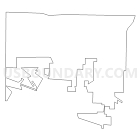
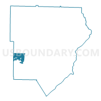
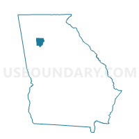
Outline
Summary
| Unique Area Identifier | 560776 |
| Name | 067ME01 - MCEACHERN 01 Voting District |
| County | Cobb County |
| State | Georgia |
| Area (square miles) | 4.37 |
| Land Area (square miles) | 4.33 |
| Water Area (square miles) | 0.04 |
| % of Land Area | 99.08 |
| % of Water Area | 0.92 |
| Latitude of the Internal Point | 33.89155980 |
| Longtitude of the Internal Point | -84.69703980 |
Maps

Graphs
Select a template below for downloading or customizing gragh for 067ME01 - MCEACHERN 01 Voting District, Cobb County, Georgia


Neighbors
Neighoring Voting District (by Name) Neighboring Voting District on the Map
- 067LM01 - LOST MOUNTAIN 01 Voting District, Cobb County, GA
- 067LM03 - LOST MOUNTAIN 03 Voting District, Cobb County, GA
- 067MC01 - MACLAND 01 Voting District, Cobb County, GA
- 067PS1A - POWDER SPRINGS 1A Voting District, Cobb County, GA
- 067PS3A - POWDER SPRINGS 3A Voting District, Cobb County, GA
- 22305 - HIRAM COMMUNITY Voting District, Paulding County, GA
- 22328 - HOPE CHURCH Voting District, Paulding County, GA
Top 10 Neighboring County Subdivision (by Population) Neighboring County Subdivision on the Map
- Acworth-Kennesaw CCD, Cobb County, GA (178,291)
- Hiram CCD, Paulding County, GA (52,219)
- Dallas CCD, Paulding County, GA (38,018)
- Powder Springs CCD, Cobb County, GA (37,454)
Top 10 Neighboring Place (by Population) Neighboring Place on the Map
Top 10 Neighboring Unified School District (by Population) Neighboring Unified School District on the Map
Top 10 Neighboring State Legislative District Lower Chamber (by Population) Neighboring State Legislative District Lower Chamber on the Map
- State House District 19, GA (73,319)
- State House District 36, GA (60,005)
- State House District 33, GA (53,275)
Top 10 Neighboring State Legislative District Upper Chamber (by Population) Neighboring State Legislative District Upper Chamber on the Map
- State Senate District 30, GA (212,492)
- State Senate District 37, GA (192,546)
- State Senate District 33, GA (158,587)
Top 10 Neighboring 111th Congressional District (by Population) Neighboring 111th Congressional District on the Map
Top 10 Neighboring Census Tract (by Population) Neighboring Census Tract on the Map
- Census Tract 315.09, Cobb County, GA (9,869)
- Census Tract 1202.02, Paulding County, GA (7,157)
- Census Tract 315.05, Cobb County, GA (5,992)
- Census Tract 1206.03, Paulding County, GA (5,934)
- Census Tract 302.34, Cobb County, GA (5,657)
- Census Tract 315.08, Cobb County, GA (5,090)
- Census Tract 315.06, Cobb County, GA (4,814)